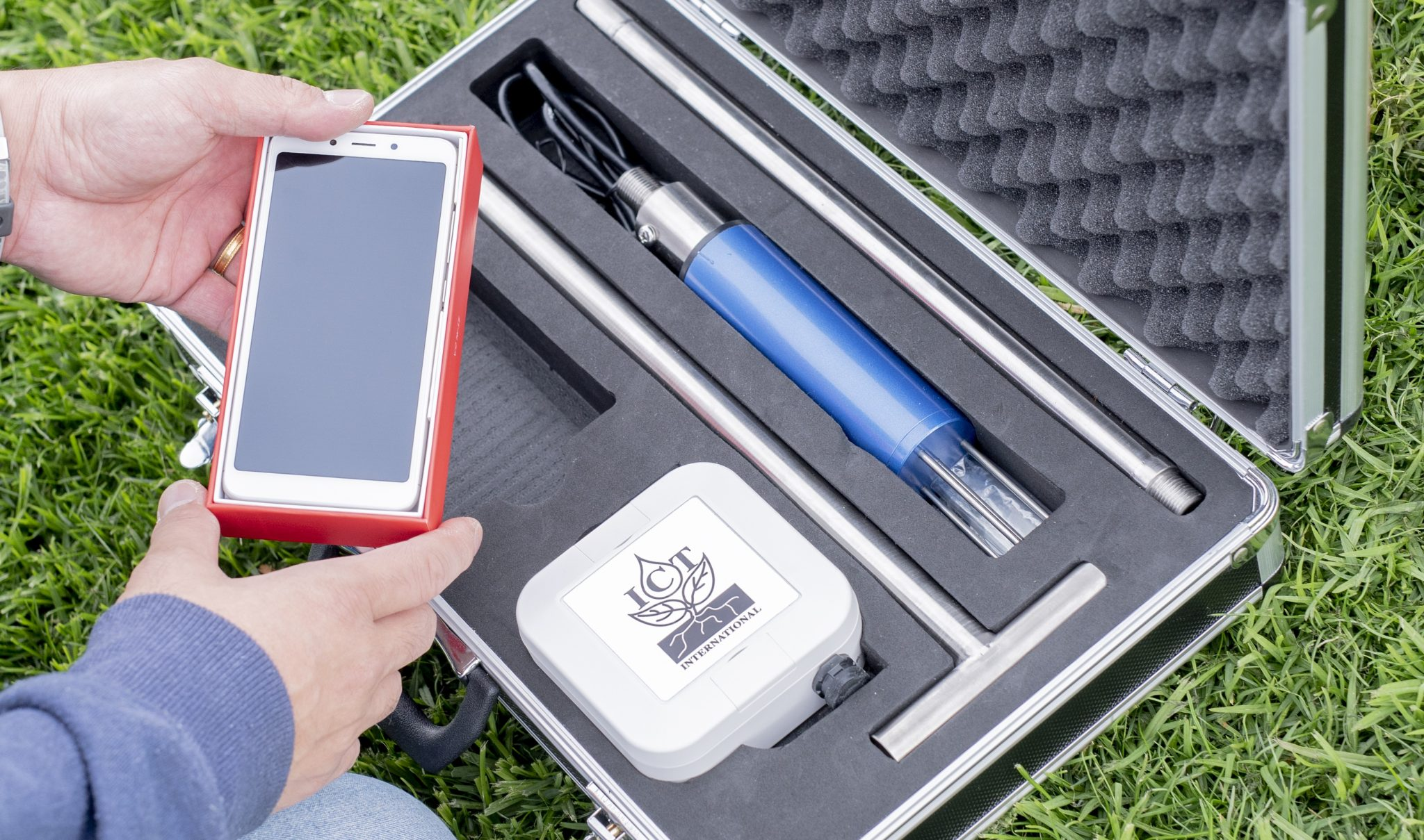
What the MPKit Measures
The MPKit is used to measure volumetric soil moisture content in a portable and practical way, making it well suited for users who need to collect soil moisture data from multiple points in the field. Because soil moisture can vary widely across locations, repeated portable measurement is valuable in helping users understand spatial differences, compare monitoring points, and build stronger insight into field conditions.
In addition to soil moisture content, the MPKit can optionally record the location of each measurement using the phone’s GPS. The collected information is stored in a CSV file for easy analysis, with latitude, longitude, time, and date recorded alongside each volumetric soil moisture reading. This makes the MPKit highly useful for field surveys, repeated measurement programs, research sampling, and commercial applications where portable, organized, and traceable soil moisture data is needed.
Portable Volumetric Soil Moisture Measurement
Measures volumetric soil moisture content in a practical format suited for multiple field readings.
GPS-Linked Location Recording
Can optionally record measurement location using the phone’s GPS, helping users connect soil moisture data with exact field positions.
CSV Data Storage
Stores data in a CSV file for easy review, analysis, and integration into broader field or research workflows.
Time and Date Tracking
Records latitude, longitude, time, and date alongside each soil moisture reading, supporting better traceability and analysis.
Multiple Field Measurements
The MPKit is ideal for taking multiple soil moisture measurements across different field locations, helping users compare soil conditions more effectively.
Commercial Monitoring
It is widely used in commercial applications where practical and portable soil moisture measurement can support field decisions and operational assessment.
Research Sampling
The MPKit supports research workflows where users need organized soil moisture readings with location and time-based reference for later analysis.
Spatial Soil Moisture Assessment
By linking readings to GPS position, the system helps users better understand how soil moisture varies across different areas of a site.
Data Logging for Later Analysis
Because results are stored in CSV format with location and time details, the MPKit supports easier post-field analysis and documentation.
MPKIT FOR PORTABLE SOIL MOISTURE MEASUREMENTS
is a portable soil moisture measurement solution that records volumetric soil moisture content and, optionally, GPS location for later analysis in commercial and research applications.